A Celebration of Learning: Canada's Land and People
Here are the Learning Intentions of our work:
SS: I can connect the land with how people need and use it.
SS: I can explain how our stories make up our provincial and national identity.
SS: I can use primary sources to broaden understanding of historical events and issues.
SS: I can develop research skills.
SS: I can make a personal connection to the land.
Art: I can explore different forms of artwork
Art: I can use the work of a model artist to experiment with different styles and media.
Throughout this school year, the Grade 4/5’s have been learning about Canada’s Land and People. We have explored each region from West Coast to East Coast to North Coast. As an anchor for each region, we have delved into examples of art from the area. From the artwork, we have observed characteristics of the land, studied the animals that live there, and learned of the history and culture of the people. Here are some highlights of our learning from each region:
Cordillera Region
Provinces/Territories: Alberta, British Columbia, Yukon Territories, North-West Territories
Description of the Land: Rocky coastline, Rocky Mountains, rough terrain, lots of rain
Other Interesting Facts: There is a desert, Elevation is from sea level to 4000 m, there are 3 cities that have over 100 000 people, has 7 towns with 10 000-100 000 people
Artists Studied: Emily Carr (British ancestry) and Jason Carter (Cree Nation)
Description of our Artwork: mountains, native art like totem poles, trees and coastal scenes
By: Vance, Seb K, James, Lawrence
Interior Plains Region
Provinces/Territories: North-West Territories, Alberta, Saskatchewan, Manitoba
Description of the Land: It is flat and good for farming. There are some hills in the south.
Other Interesting Facts from the Region: The horizon line is low. It is very dry. We grow many crops here.
Artist Studied: Valerie Doroshenko (Ukrainian and Polish ancestry)
Description of our Artwork: Our artwork had a vanishing point and a horizon line. We included hay bales and some rolling hills and farmlands.
By: Dillon, Hudson, Oscar
Canadian Shield Region
Provinces/Territories: Saskatchewan, Manitoba, Quebec, Ontario, North-West Territories
Description of the Land: large wilderness areas, forest, rocky cliffs, lakes
Other Interesting Facts from the Region: at Rock Lake you can catch walleye, bass, and lake trout. The Anishinaabe and Inuit were the first people in the Canadian Shield. The Hudson Bay company first established stations here.
Artists Studied: Lisa Myers (Indigenous Artist of Anishinaabe ancestry), Danielle Piper (Artist in Residence at the Calgary Public Library, Cree, Metis, and Denesuline ancestry)
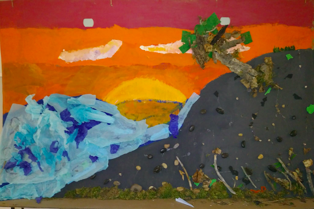
Description of our Artwork: Our artwork features rocky cliffs, trees, a flowing river, and a sunset. We were inspired by Danielle Piper. We used natural items to make it 3-dimensional.
By: Hazel, Seb C, Rochael
Great Lakes-St Lawrence Lowlands Region
Provinces/Territories that are found there: Ontario, Quebec
Description of the Land: Lots of cities, Great Lakes and St Lawrence River are main bodies of water. There is also forest.
Other Interesting Facts: People used canoes to get around because of all of the water, People came from all over to find beaver pelts. There are 9 000 dairy farms in Ontario; you can get ice cream. This region gets a lot of snow in the winter even though temperatures are usually mild, Quebec City is the second-largest French-speaking city in Canada
Description of the Artwork we studied: Lakes, rivers, trees, cottage artwork
By: Maria, Liam, Toivo
Atlantic Region
Provinces/Territories that are found there: Nova Scotia, New Brunswick, PEI, Newfoundland, and a small part of Quebec
Description of the Land: No matter where you live in the Atlantic region, you are never more than 80 km from the ocean! It is very rainy, foggy, and snowy.
Other Interesting Facts: a lot of people live next to the ocean and have jobs that relate to fishing/lobster catching. It was Vikings who first settled Newfoundland. The soil in Prince Edward Island is red and lots of potatoes grow here!
Artist Studied: Maud Lewis (British ancestry)
Description of our Artwork: features lighthouses
By: Sadie, Enzo, Daniel
Arctic Region
Provinces/Territories: Yukon, Nunavut, and NW Territories
Description of the Land: snow, open, flat, cold, long days (summer) and long nights (winter)
Other Interesting Facts: the long distances that are in between different communities means that people need to use different technologies, tourists come to the region to buy jewelry, carvings, and paintings made by local people, tourists come to the Ellesmere Island National Park and arrive by helicopter
Artist Studied: Kenojuak Ashevak (Inuit)
Description of our Artwork: animals, small communities, oceans are featured
By: Leo, Callie, Iggy
Today, we shared our Tourism Projects, encouraging people to visit the region we chose to study further. This developed our persuasive writing and speaking skills, as well as our research skills.
As a class, we will also participate in a program at Reader Rock Garden in June. The focus is the Legacy We Leave. We will reflect on Canada’s history and what we want the future of Canada to be like. We will create an Action Plan to help us achieve that. This ties well with the work we've been doing this week with the Time Capsule we received.
Our Artwork: We have explored a variety of artwork this year and used lots of different media, such as:
Chalk pastel & oil pastel (Emily Carr)
Tempera paint on canvas (Jason Carter)
Water colour paint (Valerie Doroshenko)
Tempera on paper (Maud Lewis)
Pencil crayon (Kenojuak Ashevak)
For our artwork above, we were inspired by the multi-media work of Lisa Myers, an Anishinaabe artist who lives in the Canadian Shield. She often uses natural objects, as well as found household objects, like spoons, in her artwork. Her work reflects the land around her and the traditional way of life of the Anishinaabe people in her region.
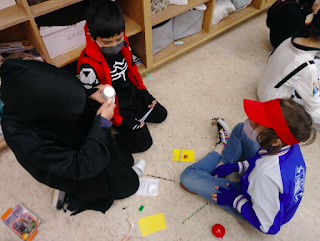
We started collecting materials during our Community Walks along the river. We mapped out a plan, then sought advice from the Indigenous Artist in Residence at the library, Danielle Piper. Danielle showed us examples of her work, where she uses porcupine quills and hides to create landscapes and drums. Danielle said to us, “You have to have the courage to pursue your gifts.” She used the Cree word, Peyakwan, when speaking with us. It roughly translates to “We Are One.” So, we’ve decided to call our collaborative Community Artwork piece, Peyakwan. It is a huge installation piece that is in the upstairs hallway outside our classroom.
We hope people learn how to better connect with nature and see ourselves as a part of nature.


